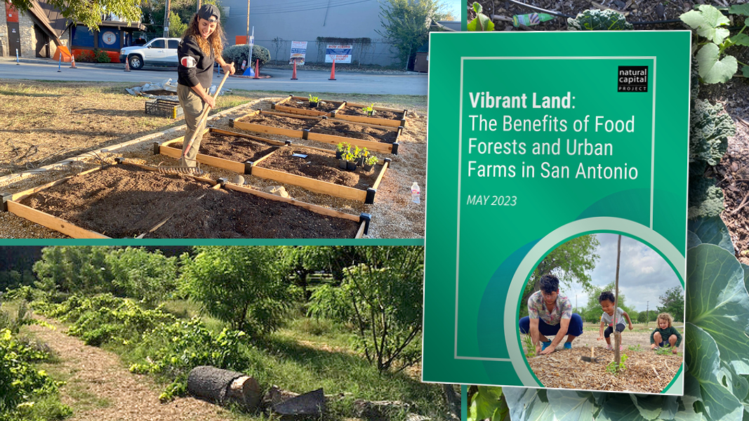
Top: Images courtesy Stanford University’s Natural Capital Project
“Vibrant Land: The Benefits of Food Forests and Urban Farms in San Antonio” is the title of a new study released by Stanford University’s Natural Capital Project. A coalition of leaders from the Food Policy Council of San Antonio, Texas and from three San Antonio city departments (Innovation, Metro Health, and Sustainability) worked with the Natural Capital Project to quantify key benefits of urban agriculture across the city of San Antonio, with the goal of making educated decisions about investments in urban agriculture. Existing San Antonio urban agriculture sites were used to inform assumptions about farming practices and crop selection and to estimate yield. State-of-the-art modeling was employed to quantify and map the environmental co-benefits of urban agriculture.
San Antonio’s Unified Development Code defines an urban farm as “a tract of land within city limits, not at one’s own residence, on which produce is raised and sold on-site or elsewhere. This can include farming on vacant lots or acreage.” Food forests are defined as “a self-sustaining, no-till system of perennial crops inter-planted in layers to mimic a mature ecosystem to provide food, a haven for beneficial, pollinating insects and other wildlife and to conserve water through topography alterations that serve to capture water in the landscape.”
The study shows that linking demand from households facing food insecurity with supply of underutilized publicly owned land for urban agriculture can help guide decision-makers in implementing urban agriculture where it will be most beneficial to vulnerable communities. For example, “District 3 and 5 have the highest rates of food insecurity, according to SNAP usage in San Antonio and are thus good locations to invest in urban agriculture,” state the authors. “However, these districts differ significantly in their supply of available underutilized lands, with District 3 having the most publicly owned green space in the city and District 5 having the least.”
The authors delve into potential cross-cutting benefits to “alleviate effects of food insecurity, urban heat, and flooding all at once.” They explored the delivery of several key co-benefits — urban cooling, carbon sequestration, access to green space, floodwater retention, and nutrient retention — provided by food forests and urban farms. “We summarized these citywide results across three scenarios of converting a maximum of 20 acres/parcel, 40 acres/parcel, and then the ‘full conversion’ scenario that assesses transitioning all of the underutilized lands to urban agriculture,” notes the report. “Overall, food forests provide significant food in addition to significant co-benefits with minimal nutrient pollution. Urban farms provide more food than urban forests, but this comes with tradeoffs of higher maintenance costs, potentially increased nutrient pollution (from over application or inefficient use of compost, for example), as well as decreases in carbon storage and green space access as compared to the current baseline of underutilized lands.”
The assessment approach being piloted by the Natural Capital Project in San Antonio will be useful for determining how much urban farms and food forests can contribute as a green infrastructure tool for storm water management in cities. The Natural Capital Project is developing a user-friendly toolkit for urban planners to apply this assessment approach and explore how different development scenarios would affect the equitable distribution of nature’s benefits. Users without particular technical expertise can change individual parcels or groups of parcels on a map to see how those changes might impact the delivery of selected benefits. The work is funded by NASA’s Environmental Equity and Justice program. The report can be downloaded at this link.